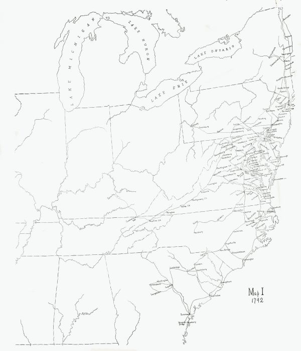
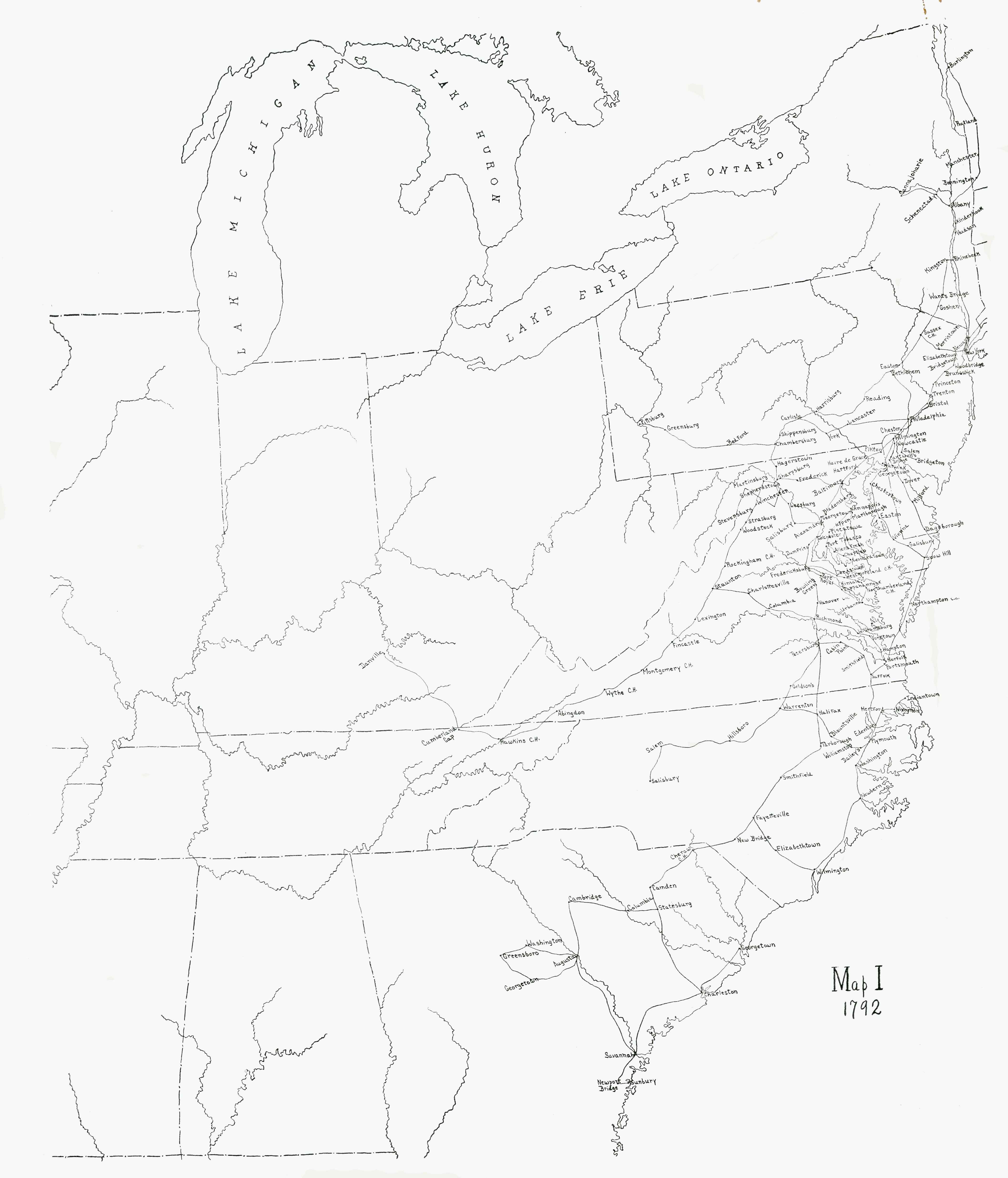
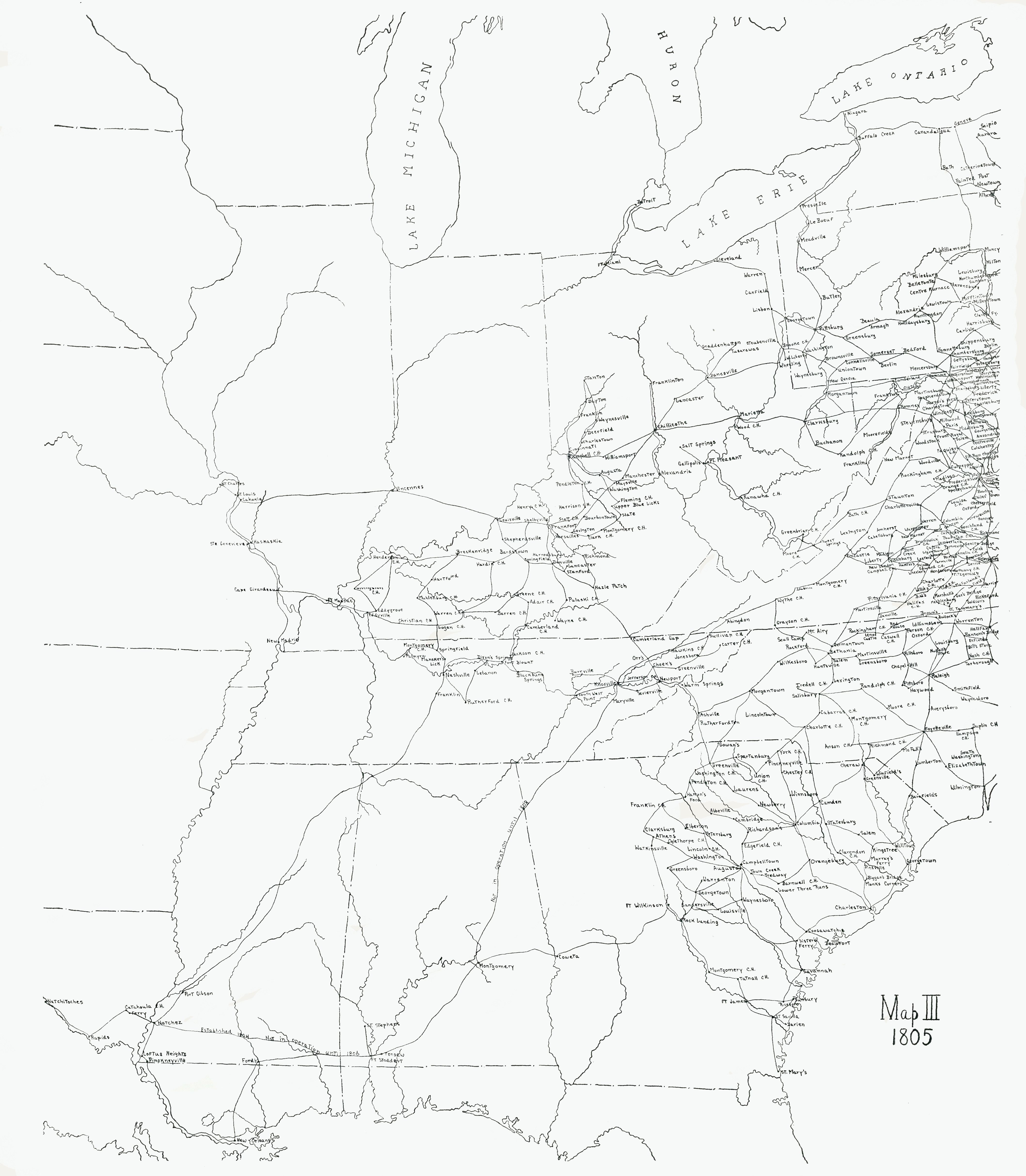
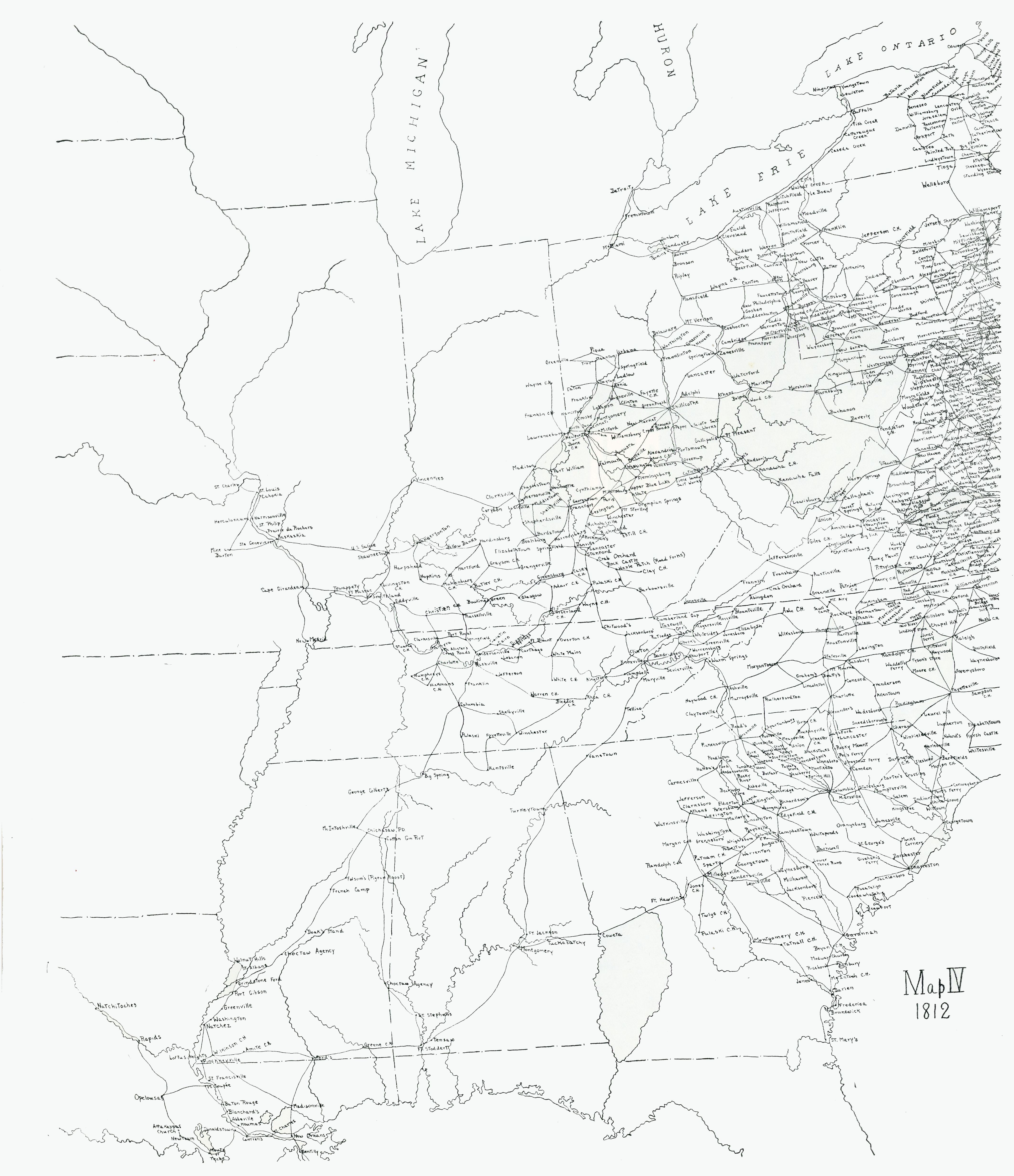
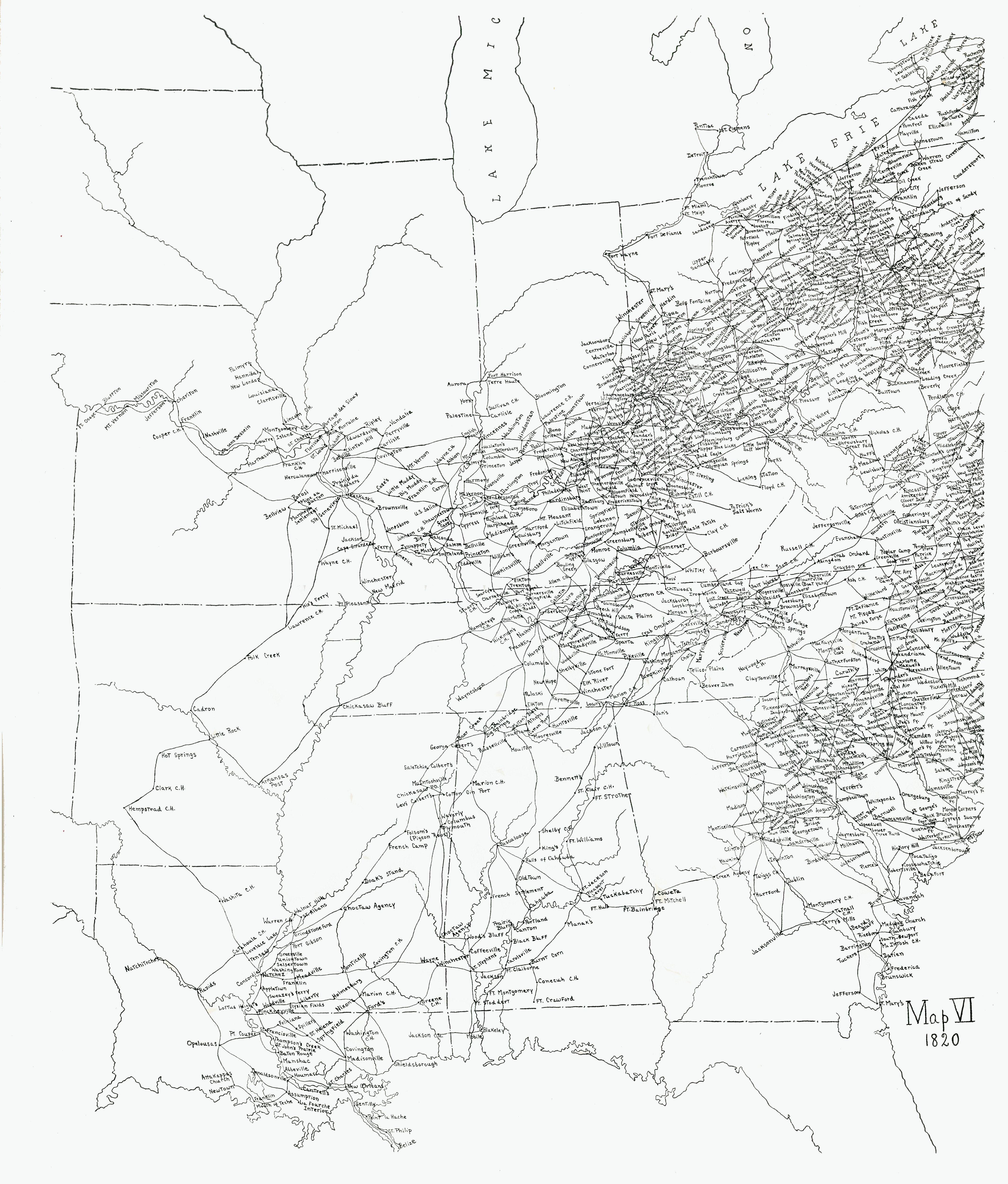
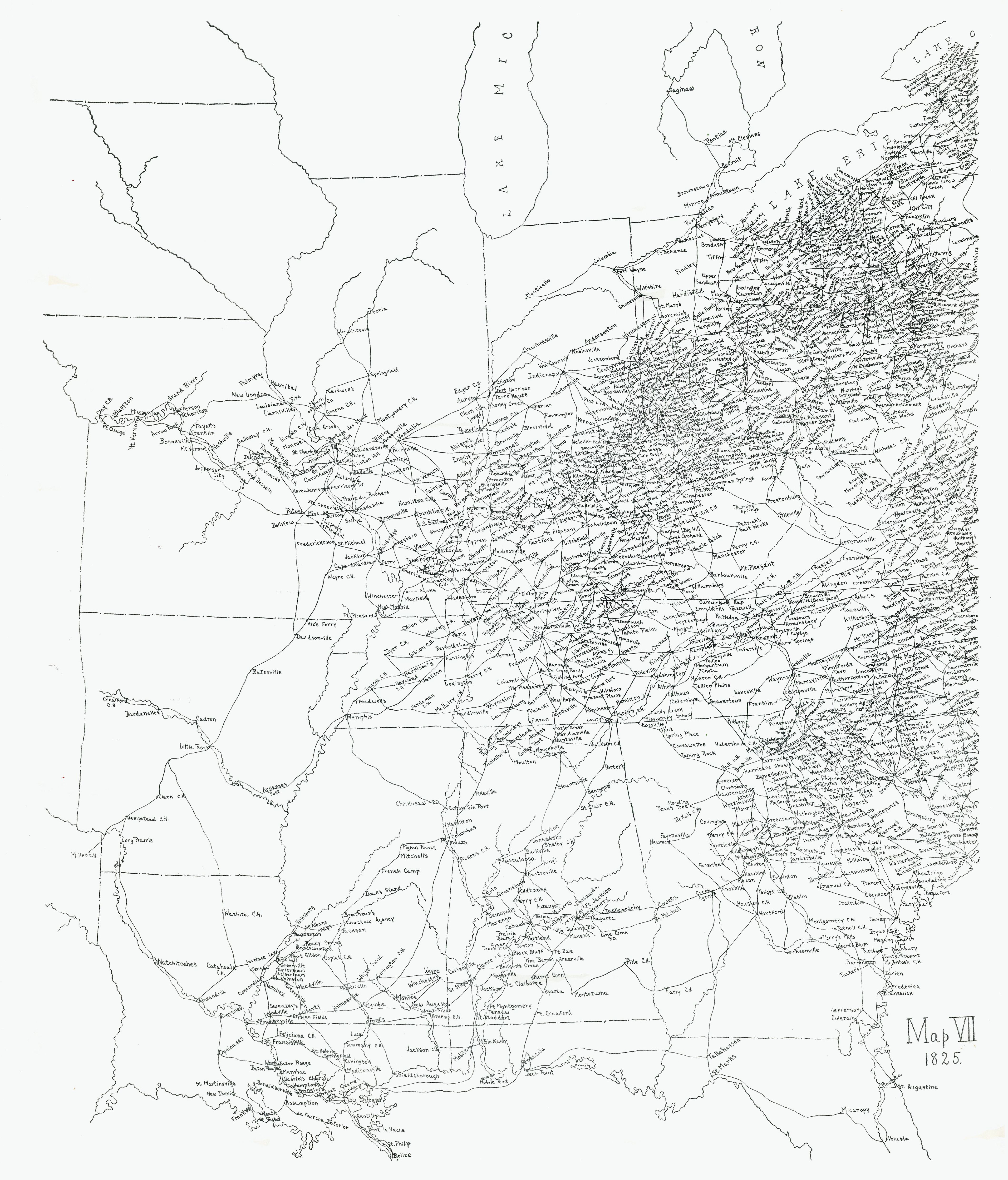
1792 to 1828
US Postal Routes Maps
Mid-West
Contributed by Russ Ryles
These hand drawn maps were gifted to me by my early mentor and long time collector of Indiana Postal History Robert (Bob) Rhodehammel, Jr. in the early 1980's when I was working on my book on Ohio County Indiana Postal History. The story is they were given to Bob by J. David Baker being produced as part of his work preparing "The Postal History of Indiana" published in 1976. Baker had sent his secretary to Washington, D.C. to glean post office and postmaster information included in this book. This is back in the era of three by five cards, hand written notes, and etc.
taken directly from old records and read off of microfilm at the expense of your dust allergies and eye sight.
Baker also had a company draftsman prepare the postmark illustrations in his book. These route maps were probably drafted from information returned from D.C. Postal routes are illustrated for seven different years on the same outline base map. The route between post office points is more a rough line than a true representation of the paths and roads of the era. I have not seen any other comparative multiple year set of postal route maps but the quest for such continues.


